NASA and SpaceX are preparing to launch Sentinel-6B, a next-generation satellite designed to monitor Earth’s oceans and sea level with exceptional precision. The mission will extend a nearly 40-year record of sea level measurements and is part of the Copernicus Sentinel-6/Jason-CS program, an international effort to better understand how fast oceans are warming and rising, and how that affects people living along the coasts.
Sentinel-6B will lift off aboard a SpaceX Falcon 9 rocket from Space Launch Complex 4E at Vandenberg Space Force Base in California. The launch is targeted for 12:21 a.m. EST on Monday, November 17, which corresponds to 9:21 p.m. PST on Sunday, November 16. NASA plans live coverage beginning at 11:30 p.m. EST on its new NASA+ streaming service, as well as on its website and social channels. The agency will provide real-time blog updates and countdown milestones, and plans on releasing images and video shortly after liftoff. For those who prefer audio only, NASA’s mission audio lines will carry live communications from the launch team without commentary.
Sentinel-6B is the second satellite in the Sentinel-6/Jason-CS pair. Its twin, Sentinel-6 Michael Freilich, was launched in 2020 and is already measuring sea level from orbit. Once Sentinel-6B reaches orbit and completes its commissioning phase, it will gradually take over as the primary satellite in the series. Its main task is to measure sea level height around the globe with centimeter-level precision, track long-term sea level rise driven by climate change, monitor ocean currents, eddies, and waves, and improve weather and storm forecasting. These data are also important for commercial and safety reasons, helping to support shipping routes and maritime operations that depend on accurate information about the state of the ocean.
To accomplish this, Sentinel-6B carries a radar altimeter and other instruments that send pulses of radio waves toward the ocean surface and record how long they take to return. By combining that timing with precise knowledge of the satellite’s position in orbit, scientists can calculate ocean surface height at many points around the world. Because around 90 percent of the excess heat trapped by greenhouse gases ends up in the ocean, sea level rise has become one of the clearest and most consequential signals of global warming. Low-lying coasts and island nations are especially vulnerable to even small changes in average sea level.
Although the spacecraft will launch from the United States and NASA has a central role, Sentinel-6B is an international mission. It is part of the Copernicus Sentinel-6/Jason-CS program and involves NASA, the European Space Agency (ESA), the European meteorological satellite organization EUMETSAT, the U.S. National Oceanic and Atmospheric Administration (NOAA), and the French space agency CNES, with additional support from the European Commission through the Copernicus Earth observation program. The mission continues a long history of cooperation that began with the TOPEX/Poseidon satellite in 1992 and continued through the Jason-1, Jason-2, and Jason-3 missions. Together, those satellites built the backbone of the global record of sea level change that climate scientists rely on today.
Sentinel-6B’s role is to keep that record continuous and consistent. Since the early 1990s, satellite data have shown that global sea level is not only rising, but that the rate of rise is accelerating. To understand how and why, and to distinguish long-term climate trends from shorter-term fluctuations such as El Niño and La Niña, researchers need uninterrupted and carefully calibrated measurements. Sentinel-6B will help extend the record so that changes from melting ice sheets and glaciers, the expansion of seawater as it warms, and shifts in ocean circulation can be tracked with greater confidence. When sea level measurements are combined with data on temperature, salinity, gravity and other parameters from different missions, scientists can build a more complete picture of how the ocean is absorbing heat and carbon and how that, in turn, feeds back into the climate system.
Ahead of the launch, NASA and its partners scheduled a pre-launch briefing to explain the mission’s goals, technical design and launch readiness. Officials from NASA’s Earth Science Division, ESA’s Sentinel-6B project, NASA’s Jet Propulsion Laboratory, NASA’s Launch Services Program, SpaceX, and the US military’s launch weather office are expected to speak. The briefing audio will be streamed publicly, and accredited media can pose questions on topics such as weather constraints, countdown procedures and early mission milestones.
NASA is also inviting the public to take part as “virtual guests.” By registering online, people can receive launch updates and reminders. They can also access curated articles, videos and educational resources about the mission, and collect a digital stamp for their NASA Virtual Guest Passport to mark their participation. The agency encourages viewers to follow along and share their experience on social media, tagging official NASA accounts on platforms such as X, Facebook and Instagram.
Sentinel-6B is not a dramatic new type of spacecraft, and it will not change sea level trends on its own. Its importance lies in something quieter: keeping watch. By maintaining a precise, long-term record of ocean height, scientists, governments and coastal communities will have a clearer view of how quickly the seas are rising and how much room remains to adapt. WaL
We Humbly Ask For Your Support—Follow the link here to see all the ways, monetary and non-monetary.
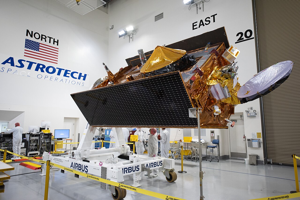
PICTURED ABOVE: Technicians transfer the Sentinel-6B spacecraft from the NASA hangar to the Astrotech Space Operations payload processing facility at Vandenberg Space Force Base in California on Thursday, Sept. 25, 2025. PC: NASA Kennedy Space Center / USSF 30th Space Wing