The 45th Session of the World Heritage Committee took place in Riyadh from the 10th to the 25th of September this year, and among the 42 new World Heritage Sites, 7 were located in Central Asia which included vast tracks of desert and whole corridors of cultural exchange owing to the Silk Roads.
Low and middle-income countries often look to World Heritage Sites as a kind of political trophies, and ways to boost tourism revenue where little other domestic industry exists. On that criteria, countries like Azerbaijan, Iran, and Tajikistan have been given a real boon from the Committee.
Central Asia has been a key part of human history going back thousands of years. Its varied peoples domesticated the horse, established the Silk Roads, and even created the largest land empire ever held together. The UNESCO History of the Civilizations of Central Asia, published in 1992, defines the region as “Afghanistan, northeastern Iran, northern and central Pakistan, northern India, western China, Mongolia and the former Soviet Central Asian republics.”
Two common methods of identifying who and what makes up Central Asia is by identifying the major ethnic groups and their historic spread and influence from Western Iranian and Caucasian peoples to the far eastern Mongols and Tatars, or by certain cultural similarities. In this case, the UNESCO definition comes very near the mark.
All the descendants of these peoples have benefitted mightily from the 45th Session of the UNESCO Committee, as more and more of this recognized heritage is being hopefully preserved for posterity forever.
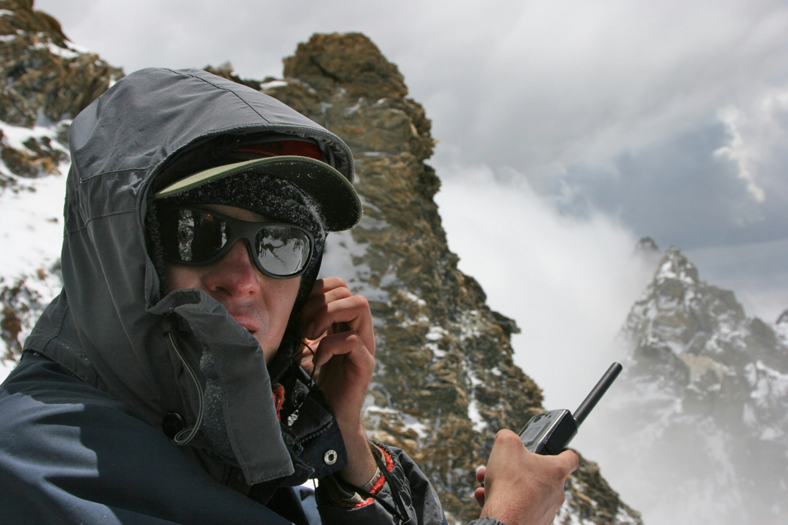
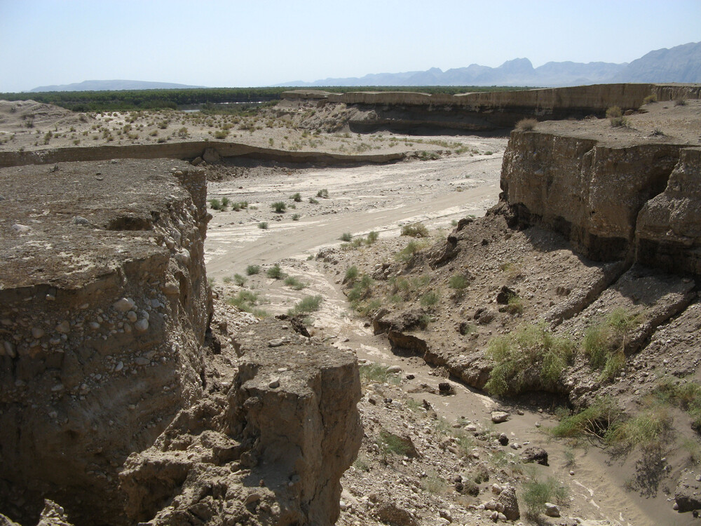
Silk Roads: Zarafshan-Karakum Corridor
The Zarafshan-Karakum Corridor is a key section of the Silk Roads in Central Asia that connects other corridors from all directions. Located in rugged mountains, fertile river valleys, and uninhabitable desert, the 866-kilometre corridor runs from east to west along the Zarafshan River and further southwest following the ancient caravan roads crossing the Karakum Desert to the Merv Oasis.
The boundaries of the site stretch across Tajikistan, Uzbekistan, and Turkmenistan, and include mosques, archaeologically-valuable ruins, irrigation channels, and necropoli.
Channeling much of the east-west exchange along the Silk Roads from the 2nd century BCE to the 16th century CE, a large quantity of goods was traded along the corridor. People traveled, settled, conquered, or were defeated here, making it a melting pot of ethnicities, cultures, religions, sciences, and technologies.
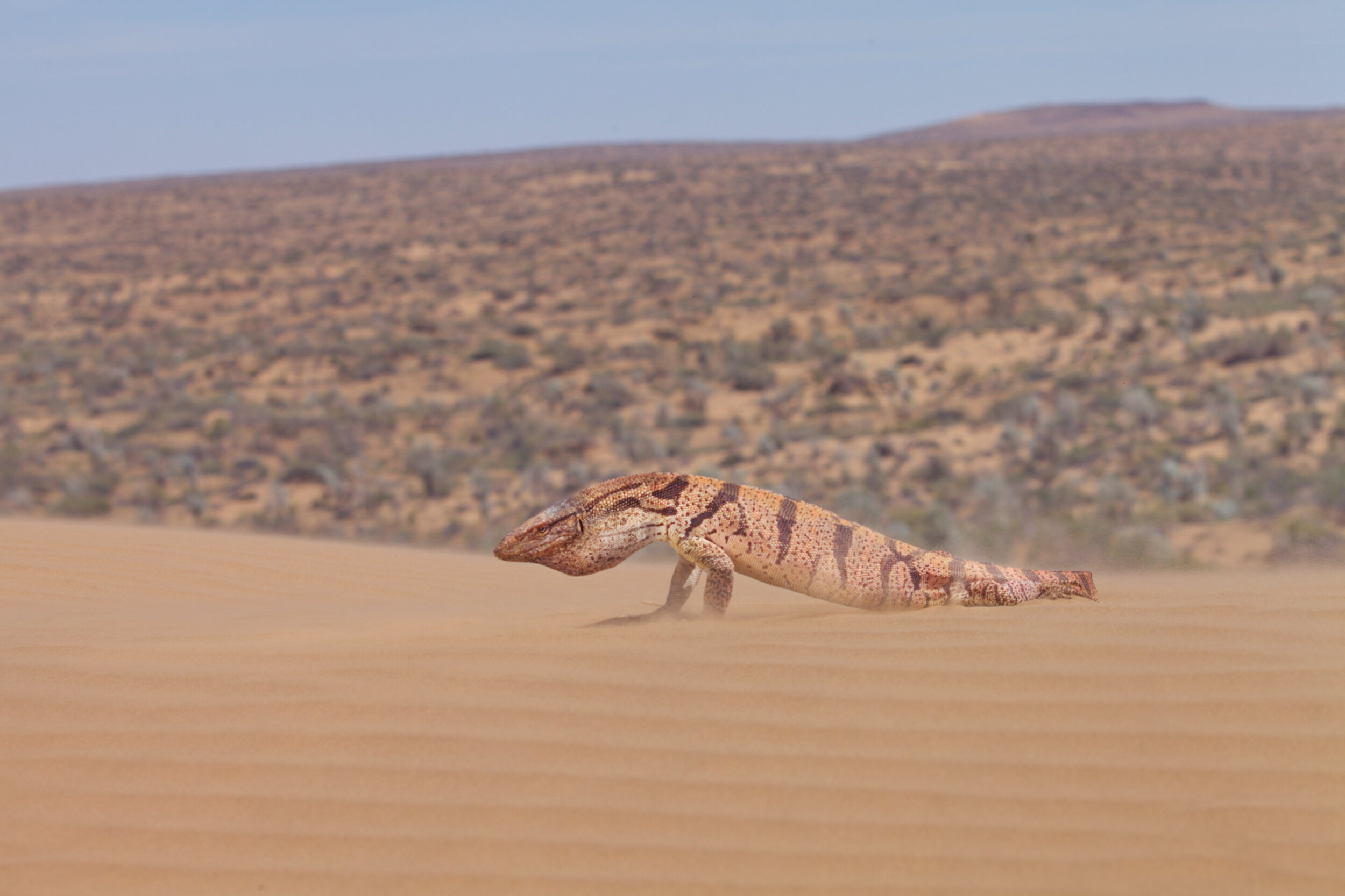
Cold Winter Deserts of Turan
In 2020, WaL reported that the International Union for the Conservation of Nature recommended that several deserts across 3 of the Central Asian “stans” were unique in the world and should be inscribed on the UNESCO Natural Heritage Sites list. These included parts of Kazakhstan, Turkmenistan, and Uzbekistan.
Now duly inscribed, the transnational property comprises fourteen component parts found across arid areas of Central Asia’s temperate zone between the Caspian Sea and the Turanian high mountains. The area is subject to extreme climatic conditions with very cold winters and hot summers, and boasts an exceptionally diverse flora and fauna that has adapted to the harsh conditions.
The property also represents a considerable diversity of desert ecosystems, spanning a distance of more than 1,500 kilometers from east to west.
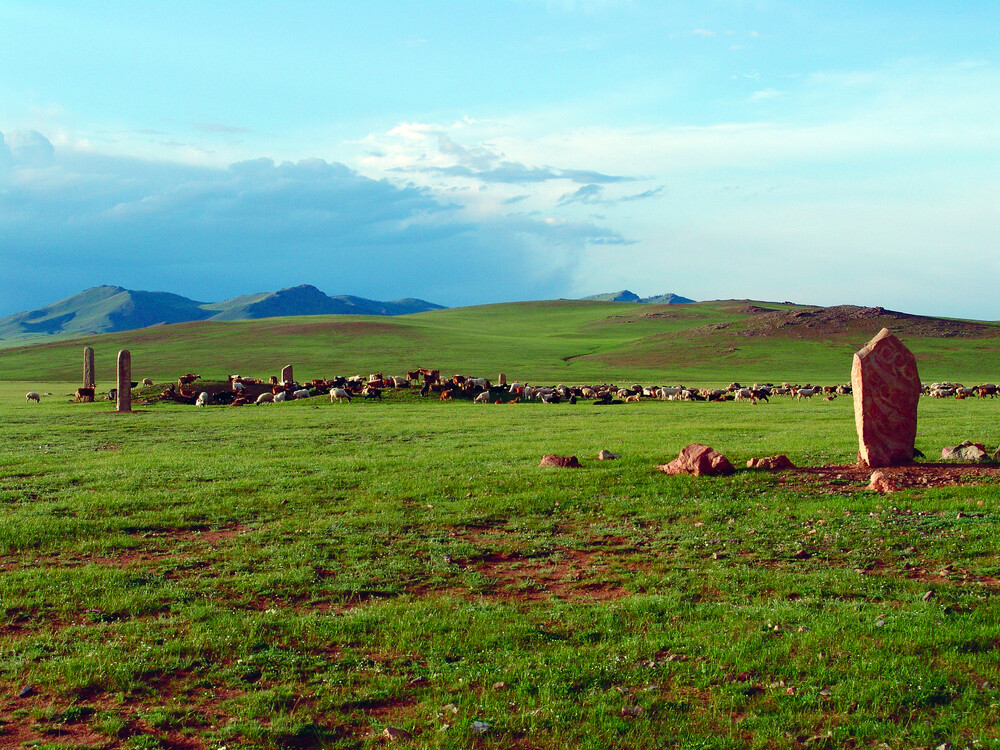
Deer Stone Monuments and Related Bronze Age Sites
Whether Mongolia is considered Central Asia proper or not, its peoples’ impact on its transformations over the millennia is undeniable, connecting culturally with Turkic people to the west, and plugging in the practices of steppe life with China’s silk to form one of the Silk Roads’ critical nodes.
Located on the slopes of the Khangai Ridge in central Mongolia, these deer stones were used for ceremonial and funerary practices. Dating from about 1,200 to 600 BCE, they stand up to four meters tall and are set directly in the ground as single standing stones or in groups, and are almost always located in complexes that include large burial mounds called khirgisüürs and sacrificial altars.
Covered with highly stylized or representational engravings of stags, deer stones are the most important surviving structures belonging to the culture of Eurasian Bronze Age nomads that evolved and then slowly disappeared between the 2nd and 1st millennia BCE.
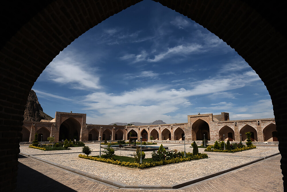
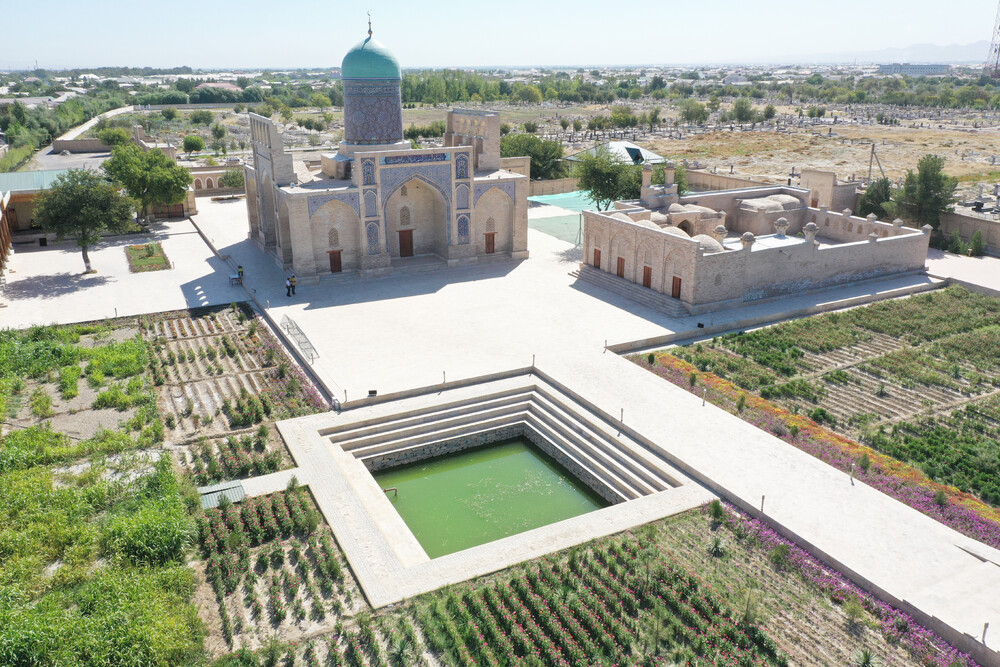
The Persian Caravanserai
Similar to the Mongolians, the Iranians, while not geographically located in traditional Central Asian territory and today often lumped into the “Middle East,” have had a defining impact on the region for thousands of years back to the days of the Persian Empire of Darius and Cyrus, who saw the eastern nomadic peoples of the steppe as somewhat like their forbearers.
Caravanserais were roadside inns, providing shelter, food, and water for caravans, pilgrims, and other travelers. The routes and the locations of the caravanserais were determined by the presence of water, geographical conditions, and security concerns.
The fifty-four caravanserais of the property are only a small percentage of the numerous caravanserais built along the ancient roads of Iran. They are considered to be the most influential and valuable examples of the caravanserais of Iran, revealing a wide range of architectural styles, adaptation to climatic conditions, and construction materials, spread across thousands of kilometers and built over many centuries. Together, they showcase the evolution and network of caravanserais in Iran, in different historical stages.
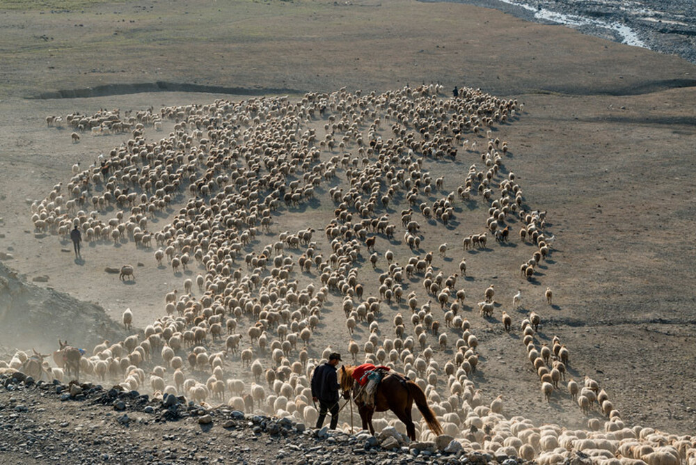
Cultural Landscape of Khinalig People and “Köç Yolu” Transhumance Route
The people of Azerbaijan keep cultural ties to Iran, Turkiye, and the Caucasus, all of which played a role in the Central Asian story, and the sea routes of the Caspian and the Black seas bordering Azerbaijan were key trading outlets for goods moving across Asia.
This cultural landscape is comprised of the high-mountain Khinalig village in northern Azerbaijan, high-altitude summer pastures and agricultural terraces in the Greater Caucasus Mountains, winter pastures in the lowland plains in central Azerbaijan, and the connecting 200-kilometer-long seasonal transhumance route called Köç Yolu (“Migration Route”).
The village of Khinalig is home to the semi-nomadic Khinalig people, whose culture and lifestyle are defined by the seasonal migration between summer and winter pastures, and who retain the ancient way of long-distance vertical transhumance. The organically evolved network including ancient routes, temporary pastures and camping sites, mausoleums, and mosques illustrates a sustainable eco-social system adapted to extreme environmental conditions.
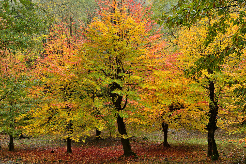
Hyrcanian Forests (Extended)
First inscribed in 1990, the Hyrcanian forests of northern Iran are an ecosystem like no other in Central Asia and are found on a unique forested massif that stretches along the southern coast of the Caspian Sea with a history dating back 25 to 50 million years.
The new component parts of Dangyaband and İstisuchay Valley (Azerbaijan) contain highly valuable ancient forests belonging to the Hyrcanian Forests and complement the already inscribed component parts in Iran.
The newly inscribed elements comprise full ecosystems including top predators such as leopard, wolf, and brown bear, and the forest has a high degree of rare and endemic tree species. The oldest trees seen here are 300-400 years old, with some possibly up to 500 years old.
Tugay forests of the Tigrovaya Balka Nature Reserve
Classic Central Asia, this property is located between the Vakhsh and Panj rivers in southwestern Tajikistan. The Reserve includes extensive riparian tugay ecosystems, the sandy Kashka-Kum desert, the Buritau peak, as well as the Hodja-Kaziyon mountains.
The property is composed of a series of floodplain terraces covered by alluvial soils, comprising tugay riverine forests with very specific biodiversity in the valley. The tugay forests in the reserve represent the largest and most intact tugay forest of this type in Central Asia, and this is the only place in the world where the Asiatic poplar tugay ecosystem has been preserved in its original state over an area of this size.
In Central Asia’s ongoing quest to restore its most famous wildlife, the Tigrovaya Balka Nature Reserve and the additional support a UNESCO listing will hopefully confer to it will continue to provide key habitat for the goitered gazelle, Bactrian deer, and the pallid scops owl. WaL
Editor’s Note: Text used here is republished from UNESCO under CC 3.0. licenses.